Are you looking at selling or leasing your commercial property?
Did you know that using Drone Photography is a cost effective way of obtaining images / footage of offices, retail parks, industrial units, factories and other land when compared to old methods.
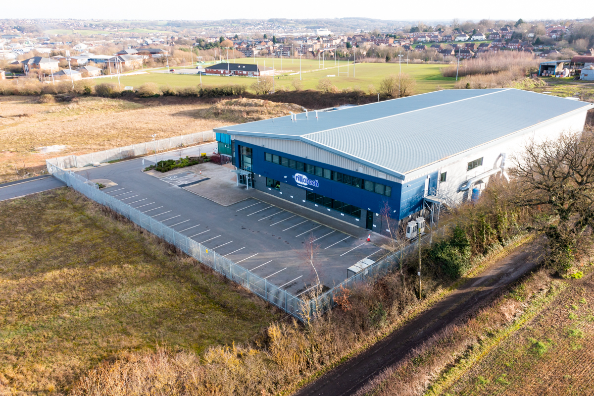
Drone Photography Rotherham utilise industry leading technology equipped with cameras capturing 20 megapixel still images and UHD 4K videos from the sky.
Aerial photos and videos allow you to capture the scale of a property, land, gardens and the surrounding area from altitudes up to 400ft.
Capturing current images / footage which is both up-to date and better quality than services such as Google Earth or Google Maps.
It’s common for potential buyers to use Google’s Maps to view satellite images, these captured images are often out of date and not a true reflection of the property. Our property aerial photography can operate grom ground level up to 400ft giving an accurate property layout
Our aerial drones can fly up to 400ft taking smooth and detailed footage of your commercial property.
Our aerial images gives potential buyers a ‘birds eye’ view that will makes your property portfolio stand out amongst the rest when listed on property website such as Zoopla, On The Market and Rightmove
For deadlines, we can offer a same day delivery for property drone aerial photography.
Take your portfolio to the next level, using drone images
Latest Projects
Far far away, behind the word mountains, far from the countries Vokalia and Consonantia, there live the blind texts separated.
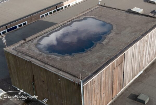
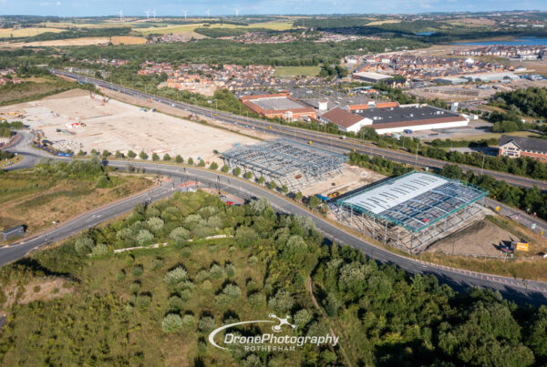
Drone reveals water build up on Rotherham roof
“We believe there could be a leak on our roof but it’s not safe for…
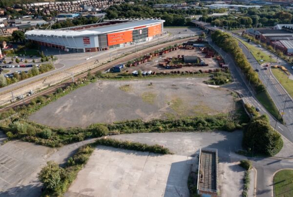
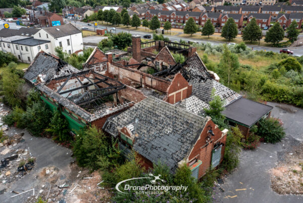
Plans submitted to reuse land behind old Rotherham nightclub
Plans have been submitted to use vacant land on the outskirts of Rotherham town centre…
Who We’ve Worked With:
Since we began operating, we’ve had the privilege to assist many companies with aerial imagery


Latest Projects
Far far away, behind the word mountains, far from the countries Vokalia and Consonantia, there live the blind texts separated.
Drone reveals water build up on Rotherham roof
“We believe there could be a leak on our roof but it’s not safe for…
Plans submitted to reuse land behind old Rotherham nightclub
Plans have been submitted to use vacant land on the outskirts of Rotherham town centre…